Sapodilla Hill
Occasional Papers Series
Occasional Papers of the Museum
The Occasional Papers is a digital publication series offered by the Turks and Caicos National Museum. It is dedicated to providing an outlet for scholarly inquiry that pertains to the history, archaeology, and culture of the Turks and Caicos Islands in particular and the Caribbean in general.
If you are interested in submitting a manuscript for electronic publication in the series, please contact the editor, Dr. Matt Williamson at mwilliam@georgiasouthern.edu.
To access a report, click on the title.
Occasional Paper #1: The Archaeological Exploration of Ft George Cay, October-November 2009 (Donald H. Keith, PhD and Toni L. Carrell, PhD)
Abstract: Archaeological exploration of Ft. George Cay began on October 23, 2009 and ended two weeks later on November 6, 2009. Impetus for this project began in 2008 with the realization that after decades of casual artifact collecting, limited historical research, and mapping, there were still no answers to even simple questions such as: How big is the site? Is it confined to Ft. George or are the surrounding cays also involved? Which military units occupied the fort? How much of the site has been lost to the sea? Were British soldiers buried on the cay? The archaeological exploration described in this report is an effort to answer some of these questions, but it is only one part of a larger effort that includes, on-going archival research, artifact conservation and analysis, museum exhibit preparation, public relations, and management planning designed to make Ft. George accessible to the public without destroying its natural beauty in the process.
Occasional Paper #2: Report to the Department of Environment and Coastal Resources of the Turks and Caicos Islands on the Archaeological Survey of Endymion Rock Nov. 27- Dec. 13, 2007 (Donald H. Keith, Ph.D)
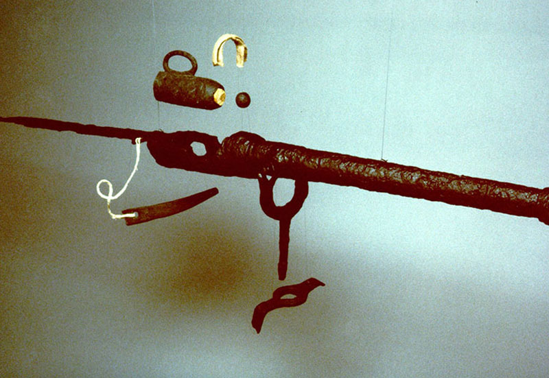
Abstract: The purpose of this investigation was twofold: to examine the HMS Endymion that ran aground August 23, 1790 on a hidden reef south of the island of Salt Cay in the Turks and Caicos Islands, BWI and field test all survey systems on board two ships from the Waitt Institute for Discovery (WID). The WID team performed a side-scan sonar and magnetometer survey of a 12 nm2 area around and beyond the reef where the Endymion is located that helped to discover and map numerous cannons, iron ballast bars, and at least two anchors. They also located the wreckage of more recent ship, tentatively identified as the General Pershing that went missing on July 11, 1921. Among the items associated with this wreck is part of a large hot bulb oil diesel engine.
Occasional Paper #3: Cheshire Hall: The Future and Potential of a Loyalist Plantation Complex on Providenciales, Turks and Caicos Islands (Donald H. Keith, Ph.D.)
Abstract: This manuscript examines the nature and condition of the architectural remains of the Colonial Period plantation complex known as Cheshire Hall located on Providenciales, Turks and Caicos Islands, BWI and reviews its archaeological potential. It is based on a survey conducted in February 2000. It is hoped that this report will be of use in evaluating the site’s present physical condition, its importance for future archaeological exploration, its historical interpretation, and possibly even its reconstruction.
Occasional Paper #4: A visit to Cotton Cay (Donald H.Keith, Ph.D. and Randel C. Davis, D.O.)
Abstract: As part of the Turks & Caicos National Museum’s continuing effort to explore and inventory sites of historical and archaeological importance in the Turks & Caicos Islands, Donald Keith and Randal Davis visited Cotton Cay over a two-day period Feb 1-2, 2002. The objectives of the visit were to re-visit the two known Lucayan sites on the island’s Northwest and North coasts, to walk entirely around the coast of the island looking for other traces of past human habitation, and to measure and survey the ruins of the stone house on the island’s Southwest coast.
Occasional Paper #5: Traveling to Market: Provision Grounds and the Caribbean Higgler (Jennifer Sweeney Tookes, Ph.D.)
Abstract: Provision grounds (small plots of land for subsistence gardens) emerged during the time of slavery in the British and French Caribbean and were intended as spaces in which the enslaved would raise food to support themselves and their families. Some enterprising individuals became so successful at their farming that they began to sell their surplus to both fellow slaves and the plantations. Over the 18th and 19th centuries, these activities gradually formed the backbone of the agricultural systems on the islands. Women became increasingly visible in new roles as sellers, or higglers, and they quickly dominated the internal marketing system. Beginning with these small provision grounds, this paper traces the emergence of higgling, discusses its development over Caribbean history, and situates the role of agriculture and market women in the development of the modern agricultural system contemporary forms of higgling.
Occasional Paper #6: 1984 Boat Building Project Grand Turk (Leslie W. Milligan & Jean De St. Croix)
Abstract: For almost three hundred years, the inhabitants of the Turks and Caicos Islands have depended on small sloops for their commerce, fishing and transportation. These native boats have generally been small because of limitations imposed on them by the shallow waters surrounding the islands and the scarcity of suitable native wood. The largest of these sloops were approximately thirty feet overall and were used as lighters to haul local products principally salt, dried conch and sisal to ships anchored off shore. A small version of the boat, approximately sixteen feet, was used for fishing in the shallow banks off the Caicos Islands. Changing commercial needs, modern transportation between the Islands by aircraft and more efficient fishing practices have made the native sloops obsolete. With this change the skills associated with construction and sailing such craft are now possessed by only a handful of men scattered throughout the Islands. The purpose of this project was to record the construction techniques formerly used by constructing a sixteen foot version of the sloop using the same type of tools and materials that had been traditionally used. To accomplish this, an old time boat builder directed a volunteer team of assistants. Associated with this project was an effort to record the oral history of the boat builders and the people who sailed these sloops.
Occasional Paper #7: Report of Archaeological Investigations at Cotton Cay, Turks & Caicos Islands (Shaun Sullivan Ph.D. & Glen Freimuth Ph.D.)
Abstract: Controlled surface collections and subsurface testing were conducted at the Cotton Cay 2 (CC-2) site on Cotton Cay, Turks and Caicos Islands, during July and August 2014. Materials recovered included charcoal utilized for radiocarbon dating, aboriginal ceramics, and extensive invertebrate and vertebrate faunal remains, to include shell, coral and bone. The presence of Lucayan Period Palmetto Ware ceramics, in combination with the stylistic characteristics of imported ceramics from the Greater Antilles, and radiocarbon dates from subsurface charcoal samples, indicate an occupation ranging from the late 14th to at least mid-15th century AD. The terminal occupation may have extended into the Spanish contact period, as suggested by an earlier uncontrolled surface collection of a fragment of early 16th century Spanish Melado Ware on the site, but no contact period artifacts were recovered during the 2014 investigations. The vertebrate remains reflected a focus on marine resources, with particular concentration on fish species found in coral reef zones, and on Strombus Sp. -- which are most common in sea grass flats; both of these environmental zones are proximal to the site. The limited amount of ceramics recovered from the site, in combination with extensive evidence of burning and profuse faunal remains, suggest that CC-2 was the subject of repeated visits for food collection and processing.
Occasional Paper #8: The Turks & Caicos Islands: The Beginning of a New Era (Carlton Mills, Ed.D.)
By being administered by various countries, the TCI was denied adequate political growth and constitutional advancement as decisions were always in the hands of an external power with the local population as onlookers. On 4th July, 1959, the islands became a separate colony assuming full Crown Colony status with Britain. Another major development took place with the implementation of the 1959 Constitution (the first of its kind in TCI political history). The Constitution also marked the end of Jamaica’s administration of the TCI. A third major development gave rise to the creation of an Executive Council and Legislative Assembly with an Administrator as President. These individuals were the architects along with others of the new constitution. Although the TCI currently has an established Public Service Commission and Ministerial Government, the members of the first Executive Council and Legislative Assembly have not been given much credit for their stellar initiatives in laying the foundation, despite these instruments not being formalized in their time.
Occasional Paper #9: Steps to Avert the Evils Which Threaten: British Military Operations on Hassell Island During the Napoleonic Wars, St. Thomas, U.S. Virgin Islands (Stephen A. Hammock, RPA, DPhil Candidate, Institute of Archaeology, University of Oxford)
This report presents the results of historical research conducted to document the British military occupation on Hassel Island, which lies just south of Charlotte Amalie, the capital and largest city in the U.S. Virgin Islands. This Danish island was occupied twice by the British during the Napoleonic Wars, due to Denmark’s alliance with France. The first occupation occurred from 1801-1802 and the second from 1807-1815, when the British withdrew following the final defeat of Napoleon. Several fortifications were constructed and/or rebuilt by the Royal Engineers during the occupation, including Fort (or Battery). Shipley in the north-central portion of the island, Prince Frederik’s Battery (renamed Fort Willoughby by the British) on the southeastern coast, and Battery Cowell in the south-central part of the island. In addition to these structures, an officers’ quarters complex, an enlisted men’s barracks complex, and a garrison house used for ordnance storage were also constructed during the British occupation.
Occasional Paper #10: Final Report of Archaeological Investigations at Lucayan Site MC-12, Middle Caicos:1976-2014 (Shaun Sullivan, Ph.D and Glen Freimuth, Ph.D )
MC-12 was located in 1976 and is one of 35 archaeological sites identified during the 1976-1977 archaeological surveys on Middle Caicos Island. It sits just inland from the beach ridge on the north coastal sandy plain, predominated by Dwarf Chrysobalanus Shrubland. It was occupied from the 11th to 14th centuries of the Current Era and was settled by colonist bearers of Lucayan Arawak culture, makers of local Palmetto Ware ceramics at the time of settlement. The site was well situated to support a mixed economic strategy of maritime trade (including salt as a trade commodity), fishing, agriculture and, to a lesser degree, terrestrial hunting. The occupants of MC-12 heavily exploited fish and shellfish resources in the nearby tide washed rocky shore, as well as maritime flats, patch reefs, and barrier reefs. During the Lucayan occupation, the site was involved in periods of intensive trade and visitation with Taino kin and trading partners in the Greater Antilles, to include populations in northwestern Hispaniola, makers of ceramics principally in the Chicoid tradition but influenced by Meillacoid motifs. Through time the percentage of imported ceramics on site declined, reflecting intensification of native Lucayan culture, local population growth, and a shift to local control of resources, notably, salt. The terminal date of MC-12 is close to the time of establishment of the complex ceremonial site, MC-6. The settlement of MC-6, astride an aboriginal-built road to the primary source of salt, Armstrong Pond, served to establish local physical and symbolic control of salt, a vital trade resource.
Occasional Paper #11: "Maravedi Cove" West Caicos: A Site of Historical and Archaeological Importance to theTurks & Caicos Islands (Donald H. Keith, PH.D.)
Maravedí Cove, a site of major archaeological and historical potential located on the west coast of West Caicos, was accidentally discovered in 1980. The site has produced prehistoric and historic artifacts and inscriptions spanning more than 500 years. The impetus for the visit was the recent return of the “Spillar Coin” to the Turks and Caicos National Museum and a desire to check the condition of the Maravedí Cove site which had not been visited by archaeologists since 1985.
